Chrudim District (Okres Chrudim)
The district has mostly flat terrain with slopes of Iron Mountains appearing on the south. Seč Dam is the largest water surface in the district (2.2 km2), Chrudimka is the longest river in the district (104 km). Industrial centres are Chrudim (mechanical engineering, textile, food industry), Hlinsko (electrotechnical, textile) and Skuteč (textile). Climatic conditions and terrain make the area convenient for agriculture.
Tourism is concentrated on Seč Dam and historical architecture. Of note is historical centre of Chrudim, hippology museum in Slatiňany, castles Košumberk, Lichnice, Rychmburk and Oheb, war memorial in Ležáky and Veselý Kopec Skansen.
Among notable persons associated with the district are inventor Josef Ressel, composers Zdeněk Fibich and Vítězslav Novák, writers Karel Václav Rais and Jaroslav Vrchlický, painters Antonín Slavíček, Antonin Chittussi and Adolf Kosárek.
Map - Chrudim District (Okres Chrudim)
Map


Country - Czech_Republic
 |
 |
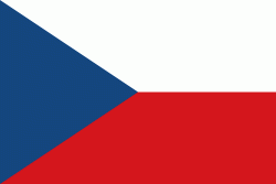
| Flag of the Czech Republic | |
The Duchy of Bohemia was founded in the late 9th century under Great Moravia. It was formally recognized as an Imperial State of the Holy Roman Empire in 1002 and became a kingdom in 1198. Following the Battle of Mohács in 1526, the whole Crown of Bohemia was gradually integrated into the Habsburg monarchy. The Protestant Bohemian Revolt led to the Thirty Years' War. After the Battle of White Mountain, the Habsburgs consolidated their rule. With the dissolution of the Holy Empire in 1806, the Crown lands became part of the Austrian Empire.
Currency / Language
| ISO | Currency | Symbol | Significant figures |
|---|---|---|---|
| CZK | Czech koruna | KÄ | 2 |
| ISO | Language |
|---|---|
| CS | Czech language |
| SK | Slovak language |